
Make a donation
Gear up for your next adventure:
As an Amazon Associate, this site earns from qualifying purchases at no extra cost to you.
Alberique topographic map
Click on the map to display elevation.
Make a donation
Gear up for your next adventure:
As an Amazon Associate, this site earns from qualifying purchases at no extra cost to you.
Alberique
La villa se encuentra en la llanura, entre la margen izquierda del Júcar y la acequia Real, al pie de una pequeña elevación del terreno de 50 m de altitud y 40 hectáreas de extensión, donde se ha formado un pequeño bosque mediterráneo.
Make a donation
Gear up for your next adventure:
As an Amazon Associate, this site earns from qualifying purchases at no extra cost to you.
About this map
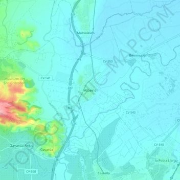
Name: Alberique topographic map, elevation, terrain.
Average elevation: 115 ft
Minimum elevation: 56 ft
Maximum elevation: 591 ft
Make a donation
Gear up for your next adventure:
As an Amazon Associate, this site earns from qualifying purchases at no extra cost to you.