Geolocate

Ponchatoula topographic map

Click on the map to display elevation.

Ponchatoula

Ponchatoula is located at 30°26′21″N 90°26′33″W / 30.43917°N 90.44250°W / 30.43917; -90.44250 (30.439162, -90.442507) and has an elevation of 26 feet (7.9 m). According to the United States Census Bureau, the city has a total area of 4.2 square miles (11 km2), all land.

About this map

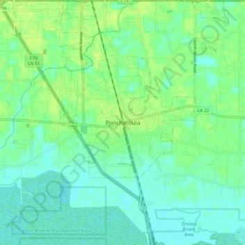
Name: Ponchatoula topographic map, elevation, terrain.

Location: Ponchatoula, Tangipahoa Parish, Louisiana, 70454, United States (30.39880 -90.48148 30.47880 -90.40148)

Average elevation: 23 ft

Minimum elevation: 3 ft

Maximum elevation: 46 ft

Tangipahoa Parish trails, hiking, mountain biking, running and outdoor activities

Gear up for your next adventure:

Solar GPS Watches - Advanced multisport watches with built-in topographic maps
🪄Magnetic Compass - Accurate compass for navigation
🥩Freeze-Dried Meals - Nutritious and lightweight food for remote expeditions
📶Vehicle Signal Boosters - Improve reception in rural areas while driving to trailheads
📦Dry Bags Set - Waterproof storage for electronics and clothes

As an Amazon Associate, this site earns from qualifying purchases at no extra cost to you.