
Make a donation
Gear up for your next adventure:
As an Amazon Associate, this site earns from qualifying purchases at no extra cost to you.
Heffen topographic map
Click on the map to display elevation.
Make a donation
Gear up for your next adventure:
As an Amazon Associate, this site earns from qualifying purchases at no extra cost to you.
Heffen
Heffen ligt aan de monding van de Zenne op een hoogte van ongeveer 5 meter. Men vindt hier het Zennegat, waar de Zenne en het Kanaal Leuven-Dijle uitmonden in de Dijle. Aan de overzijde van de Dijle, op het grondgebied van Walem, ligt het natuurgebied Battenbroek.
Make a donation
Gear up for your next adventure:
As an Amazon Associate, this site earns from qualifying purchases at no extra cost to you.
About this map
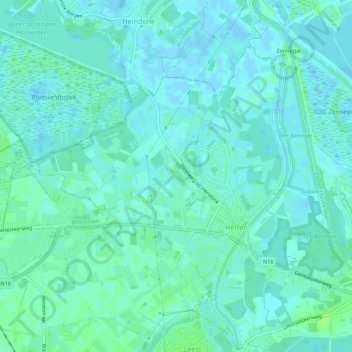
Name: Heffen topographic map, elevation, terrain.
Location: Heffen, Mechelen, Antwerpen, Vlaanderen, 2801, België (51.03623 4.37589 51.06756 4.43047)
Average elevation: 10 ft
Minimum elevation: -10 ft
Maximum elevation: 30 ft
Make a donation
Gear up for your next adventure:
As an Amazon Associate, this site earns from qualifying purchases at no extra cost to you.