Geolocate

Sanger topographic map

Click on the map to display elevation.

About this map

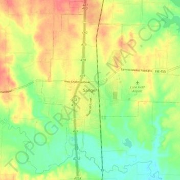
Name: Sanger topographic map, elevation, terrain.

Location: Sanger, Denton County, Texas, 76266, United States (33.32317 -97.21390 33.40317 -97.13390)

Average elevation: 673 ft

Minimum elevation: 581 ft

Maximum elevation: 768 ft

Denton County trails, hiking, mountain biking, running and outdoor activities

Gear up for your next adventure:

🧦Merino Wool Socks - Moisture-wicking, blister-preventing socks for long treks
🧥Waterproof Jacket for Hiking - Breathable and rugged rain jacket for outdoor excursions
🔌Solar Panel Charger - Charge gear sustainably outdoors
🎒Day Hiking Backpack - Lightweight backpack perfect for day trips and outdoor adventures
🔥Camping Stove - Portable stove for camping and backcountry cooking

As an Amazon Associate, this site earns from qualifying purchases at no extra cost to you.