

Guidel topographic map
Click on the map to display elevation.
Guidel
L'intérieur du finage communal forme pour l'essentiel un plateau situé vers une cinquantaine de mètres d'altitude, culminant à 64 mètres d'altitude à Kermémé près de la limite orientale de la commune. Sa partie nord-est est parcourue par un affluent de la Scave (elle-même affluent de rive droite du Scorff), le ruisseau de Pont er Ber (lequel sépare Guidel de sa voisine nord-orientale, Gestel) et son affluent le ruisseau du Fond de Lann Hir.
About this map
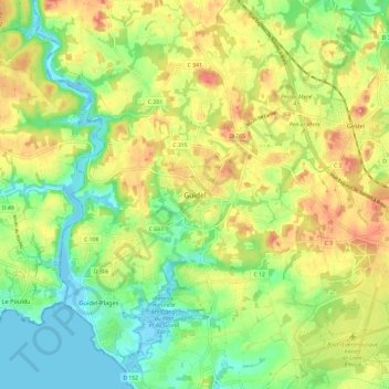
Name: Guidel topographic map, elevation, terrain.
Average elevation: 112 ft
Minimum elevation: -13 ft
Maximum elevation: 249 ft