
Thank you for supporting this site ❤️
Make a donation
Make a donation
Gear up for your next adventure:
As an Amazon Associate, this site earns from qualifying purchases at no extra cost to you.
Beerzel topographic map
Click on the map to display elevation.
Thank you for supporting this site ❤️
Make a donation
Make a donation
Gear up for your next adventure:
As an Amazon Associate, this site earns from qualifying purchases at no extra cost to you.
About this map
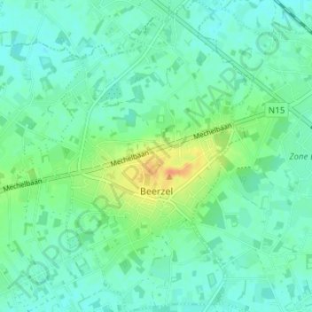
Name: Beerzel topographic map, elevation, terrain.
Location: Beerzel, Putte, Mechelen, Antwerp, Flanders, Belgium (51.04357 4.64217 51.08248 4.68925)
Average elevation: 56 ft
Minimum elevation: 23 ft
Maximum elevation: 138 ft
Thank you for supporting this site ❤️
Make a donation
Make a donation
Gear up for your next adventure:
As an Amazon Associate, this site earns from qualifying purchases at no extra cost to you.