Geolocate

Cheoah Bald topographic map

Click on the map to display elevation.

About this map

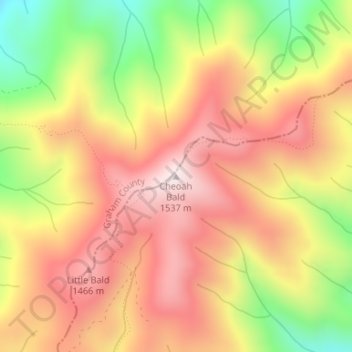
Name: Cheoah Bald topographic map, elevation, terrain.

Location: Cheoah Bald, Swain County, North Carolina, United States (35.32530 -83.68088 35.32540 -83.68078)

Average elevation: 4,180 ft

Minimum elevation: 3,045 ft

Maximum elevation: 5,010 ft

Swain County trails, hiking, mountain biking, running and outdoor activities

Other topographic maps

Click on a map to view its topography, its elevation and its terrain.

Gear up for your next adventure:

🗺️Topographic Maps - Detailed topo maps for hiking, exploring and outdoor navigation
🔋Solar Power Banks - Keep your GPS and phone charged in remote wilderness areas
🥾Women's Hiking Boots - Top-rated trail boots with ankle support and superior grip
🧭Outdoor Navigation Book - Learn advanced navigation skills
🧯Emergency Survival Kit - All‑in‑one survival essentials for the backcountry

As an Amazon Associate, this site earns from qualifying purchases at no extra cost to you.