Geolocate

Monte Delgado topographic map

Click on the map to display elevation.

About this map

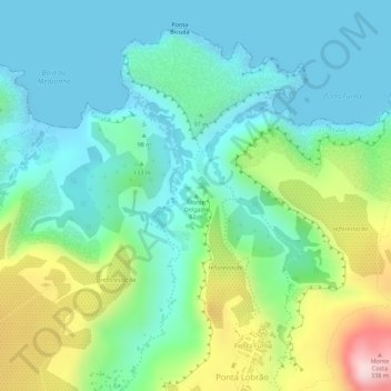
Name: Monte Delgado topographic map, elevation, terrain.

Location: Monte Delgado, Ponta Lobrão, Tarrafal, Cape Verde (15.32331 -23.71217 15.32341 -23.71207)

Average elevation: 312 ft

Minimum elevation: -3 ft

Maximum elevation: 1,053 ft

Gear up for your next adventure:

🦟Ultrasonic Repellers - Create a bug-free zone at your camp or rest stop
🥤Water Filter Bottle - All‑in‑one filter bottle for safe hydration
🦶Hiking Gaiters - Keep debris and water out of your boots
👟Trail Running Shoes - Lightweight shoes for trail runners
🚁Photography Drones - Capture stunning aerial views of landforms and topography

As an Amazon Associate, this site earns from qualifying purchases at no extra cost to you.