
Igalo topographic map
Interactive map
Click on the map to display elevation.
About this map
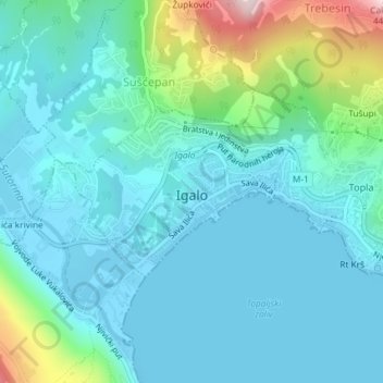
Name: Igalo topographic map, elevation, terrain.
Location: Igalo, Herceg Novi Municipality, 85347, Montenegro (42.45293 18.49816 42.46497 18.51696)
Average elevation: 233 ft
Minimum elevation: -7 ft
Maximum elevation: 1,293 ft