Geolocate

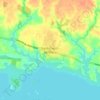
Lamarche topographic map

Click on the map to display elevation.

About this map

Name: Lamarche topographic map, elevation, terrain.

Location: Lamarche, Lac-Saint-Jean-Est, Saguenay–Lac-Saint-Jean, Québec, G0W 1X0, Canada (48.74049 -71.55088 48.84949 -71.32153)

Average elevation: 817 ft

Minimum elevation: 551 ft

Maximum elevation: 2,110 ft

Other topographic maps

Click on a map to view its topography, its elevation and its terrain.

Lacs Thivierge

Canada > Québec > Lac-Saint-Jean-Est > Alma > L'Île-d'Alma

Average elevation: 361 ft

Lac Vert

Canada > Québec > Lac-Saint-Jean-Est > Hébertville

Average elevation: 581 ft

Lac Meilleur

Canada > Québec > Lac-Saint-Jean-Est > Lac-Moncouche

Average elevation: 1,578 ft

Lac Savane

Canada > Québec > Lac-Saint-Jean-Est > Lamarche

Average elevation: 715 ft

Lac Sophie

Canada > Québec > Lac-Saint-Jean-Est > Alma > L'Île-d'Alma

Average elevation: 358 ft

Lac Barnabé

Canada > Québec > Lac-Saint-Jean-Est > Hébertville

Average elevation: 1,345 ft

Grande-Décharge

Canada > Québec > Lac-Saint-Jean-Est > Alma

Average elevation: 351 ft

La Savane

Canada > Québec > Lac-Saint-Jean-Est > Labrecque

Average elevation: 600 ft

Saint-Coeur-de-Marie

Canada > Québec > Lac-Saint-Jean-Est > Alma

Average elevation: 361 ft

Saint-Coeur-de-Marie

Canada > Québec > Lac-Saint-Jean-Est > Alma

Average elevation: 361 ft

Gear up for your next adventure:

🏫Relief Map Kits - Hands-on tools for teaching landforms and elevation
📡GPS Antenna Upgrade - Enhance GPS reception in remote terrain
📦Gear Storage Bags - Organize and protect outdoor equipment
🚁Photography Drones - Capture stunning aerial views of landforms and topography
🔭Stargazing Telescopes - Perfect for camping in low-light pollution areas shown on maps

As an Amazon Associate, this site earns from qualifying purchases at no extra cost to you.