Geolocate

Pakhowal topographic map

Click on the map to display elevation.

About this map

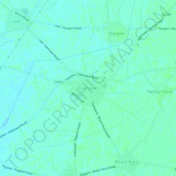
Name: Pakhowal topographic map, elevation, terrain.

Location: Pakhowal, Raikot Tahsil, Ludhiana, Punjab, 141108, India (30.68685 75.68767 30.72685 75.72767)

Average elevation: 804 ft

Minimum elevation: 794 ft

Maximum elevation: 814 ft

Gear up for your next adventure:

🌡️Portable Weather Meter - Track weather conditions on the trail
🔥Fast-Boil Camping Stoves - Efficient cooking systems for quick trail meals
🪑Portable Camp Table - Compact table for campsite meals
🏕️Tent Footprint - Protect your tent base from wear
🔦Compact Flashlight - Reliable flashlight for emergencies

As an Amazon Associate, this site earns from qualifying purchases at no extra cost to you.