
Lake Talihina topographic map
Interactive map
Click on the map to display elevation.
About this map
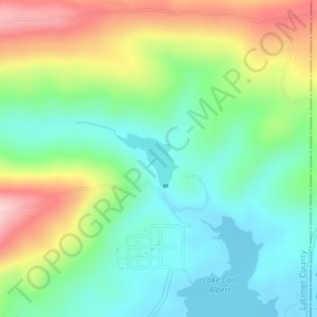
Name: Lake Talihina topographic map, elevation, terrain.
Location: Lake Talihina, Latimer County, Oklahoma, United States (34.78215 -95.07996 34.78663 -95.07332)
Average elevation: 1,040 ft
Minimum elevation: 758 ft
Maximum elevation: 1,558 ft
Other topographic maps
Click on a map to view its topography, its elevation and its terrain.
Wilburton
United States > Oklahoma > Latimer County
Wilburton, Latimer County, Oklahoma, United States
Average elevation: 679 ft
Wilburton
United States > Oklahoma > Latimer County > Wilburton
Wilburton, Latimer County, Oklahoma, 74578, United States
Average elevation: 719 ft
Hughes
United States > Oklahoma > Latimer County > Hughes
Hughes, Latimer County, Oklahoma, 74566, United States
Average elevation: 646 ft
Red Oak
United States > Oklahoma > Latimer County > Red Oak
Red Oak, Latimer County, Oklahoma, 74563, United States
Average elevation: 620 ft