
Wilburton topographic map
Interactive map
Click on the map to display elevation.
About this map
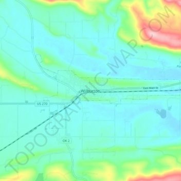
Name: Wilburton topographic map, elevation, terrain.
Location: Wilburton, Latimer County, Oklahoma, 74578, United States (34.87870 -95.34978 34.95870 -95.26978)
Average elevation: 719 ft
Minimum elevation: 591 ft
Maximum elevation: 1,240 ft