
Buldern topographic map
Interactive map
Click on the map to display elevation.
Buldern
Het dorp ligt tussen de stad Dülmen in het westen en Senden in het oosten op een hoogte van 64 meter boven normalnull.
About this map
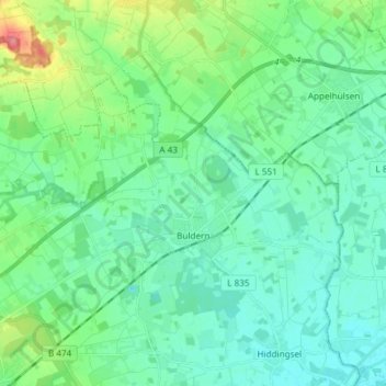
Name: Buldern topographic map, elevation, terrain.
Location: Buldern, Dülmen, Kreis Coesfeld, Noordrijn-Westfalen, Duitsland (51.84529 7.27878 51.90488 7.42745)
Average elevation: 236 ft
Minimum elevation: 177 ft
Maximum elevation: 440 ft