
Thank you for supporting this site ❤️
Make a donation
Make a donation
Gear up for your next adventure:
As an Amazon Associate, this site earns from qualifying purchases at no extra cost to you.
U-do topographic map
Click on the map to display elevation.
Thank you for supporting this site ❤️
Make a donation
Make a donation
Gear up for your next adventure:
As an Amazon Associate, this site earns from qualifying purchases at no extra cost to you.
About this map
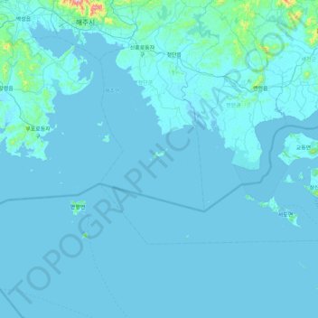
Name: U-do topographic map, elevation, terrain.
Location: U-do, Chongdan County, South Hwanghae, North Korea (37.44376 125.58214 38.08376 126.22214)
Average elevation: 49 ft
Minimum elevation: -7 ft
Maximum elevation: 2,300 ft
Thank you for supporting this site ❤️
Make a donation
Make a donation
Gear up for your next adventure:
As an Amazon Associate, this site earns from qualifying purchases at no extra cost to you.