Geolocate

Owasso topographic map

Click on the map to display elevation.

About this map

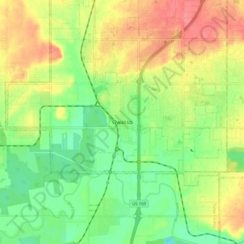
Name: Owasso topographic map, elevation, terrain.

Location: Owasso, Tulsa County, Oklahoma, 74055, United States (36.22597 -95.89486 36.30597 -95.81486)

Average elevation: 633 ft

Minimum elevation: 531 ft

Maximum elevation: 745 ft

Tulsa County trails, hiking, mountain biking, running and outdoor activities

Gear up for your next adventure:

Camping Coffee Makers - Enjoy premium coffee at the summit or campsite
👟Men's Trail Runners - Lightweight footwear for fast-paced exploration and light hiking
🦶Hiking Gaiters - Keep debris and water out of your boots
🔋Solar Power Banks - Keep your GPS and phone charged in remote wilderness areas
🗻Climbing Gear Basics - Essential gear for beginner climbers

As an Amazon Associate, this site earns from qualifying purchases at no extra cost to you.