Geolocate

Pylesville topographic map

Click on the map to display elevation.

About this map

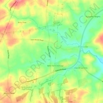
Name: Pylesville topographic map, elevation, terrain.

Location: Pylesville, Harford County, Maryland, United States (39.66865 -76.41168 39.70731 -76.36112)

Average elevation: 443 ft

Minimum elevation: 308 ft

Maximum elevation: 587 ft

Harford County trails, hiking, mountain biking, running and outdoor activities

Gear up for your next adventure:

🚗GPS Dash Cams - Record your scenic drives through mountain passes and canyons
🌐World Map Poster - Decorative world maps with topographic info
🧴Hand Sanitizer - Keep hands clean while hiking
🧣Hiking Neck Gaiter - Multi‑use neck protection for outdoor weather
📻Weather Alert Radios - Stay informed of storm risks while off-the-grid

As an Amazon Associate, this site earns from qualifying purchases at no extra cost to you.