Wuppertal topographic map
Click on the map to display elevation.
Wuppertal
Uniquely for Germany, it is a "linear city", owing to the steep hillsides along the river Wupper. Its highest hill is the Lichtscheid, which is 351 metres above sea level. The dominant urban centres Elberfeld (historic commercial centre) and Barmen (more industrial) have formed a continuous urbanized area since 1850. During the succeeding decades, “Wupper-Town” became the dominant industrial agglomeration of northwestern Germany. During the 20th century, this conurbation had been surpassed by Cologne, Düsseldorf and the Ruhr area, all with a more favourable topography.
About this map
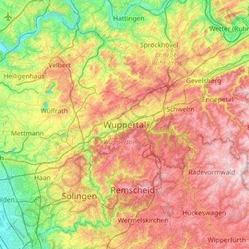
Name: Wuppertal topographic map, elevation, terrain.
Average elevation: 686 ft
Minimum elevation: 131 ft
Maximum elevation: 1,378 ft
Other topographic maps
Click on a map to view its topography, its elevation and its terrain.