
Make a donation
Gear up for your next adventure:
As an Amazon Associate, this site earns from qualifying purchases at no extra cost to you.
Stromberg topographic map
Click on the map to display elevation.
Make a donation
Gear up for your next adventure:
As an Amazon Associate, this site earns from qualifying purchases at no extra cost to you.
Stromberg
Der keltische Begriff strum für einen begrenzten Höhenrücken bezieht sich auf die befestigten vorzeitlichen Ringwälle bei Stromberg, deren Spuren auf dem gegenüberliegenden Bergrücken gefunden wurden. Die Doppelbezeichnung -berg belegt die Übernahme durch fränkische Siedler.
Make a donation
Gear up for your next adventure:
As an Amazon Associate, this site earns from qualifying purchases at no extra cost to you.
About this map
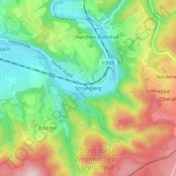
Name: Stromberg topographic map, elevation, terrain.
Average elevation: 659 ft
Minimum elevation: 276 ft
Maximum elevation: 1,247 ft
Make a donation
Gear up for your next adventure:
As an Amazon Associate, this site earns from qualifying purchases at no extra cost to you.