Geolocate

Lias topographic map

Click on the map to display elevation.

About this map

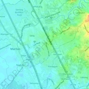
Name: Lias topographic map, elevation, terrain.

Location: Lias, Marilao, Bulacan, Central Luzon, 3019, Philippines (14.73949 120.94183 14.77949 120.98183)

Average elevation: 30 ft

Minimum elevation: 3 ft

Maximum elevation: 112 ft

Gear up for your next adventure:

🦶Hiking Gaiters - Keep debris and water out of your boots
🥾Men's Hiking Boots - Durable, waterproof footwear for rugged terrain and steep inclines
🥘Titanium Cookware - Durable, featherlight pots and pans for backpacking
🌡️Portable Weather Meter - Track weather conditions on the trail
📡Handheld GPS Device - Reliable handheld GPS for outdoor navigation

As an Amazon Associate, this site earns from qualifying purchases at no extra cost to you.