
Thank you for supporting this site ❤️
Make a donation
Make a donation
Gear up for your next adventure:
As an Amazon Associate, this site earns from qualifying purchases at no extra cost to you.
Llandrillo topographic map
Click on the map to display elevation.
Thank you for supporting this site ❤️
Make a donation
Make a donation
Gear up for your next adventure:
As an Amazon Associate, this site earns from qualifying purchases at no extra cost to you.
About this map
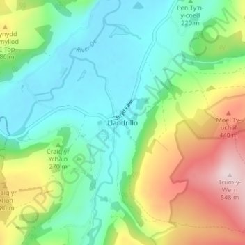
Name: Llandrillo topographic map, elevation, terrain.
Location: Llandrillo, Denbighshire, Wales, LL21 0SQ, United Kingdom (52.90217 -3.45449 52.94217 -3.41449)
Average elevation: 892 ft
Minimum elevation: 463 ft
Maximum elevation: 1,804 ft
Thank you for supporting this site ❤️
Make a donation
Make a donation
Gear up for your next adventure:
As an Amazon Associate, this site earns from qualifying purchases at no extra cost to you.