
Thank you for supporting this site ❤️
Make a donation
Make a donation
Gear up for your next adventure:
As an Amazon Associate, this site earns from qualifying purchases at no extra cost to you.
Dante topographic map
Click on the map to display elevation.
Thank you for supporting this site ❤️
Make a donation
Make a donation
Gear up for your next adventure:
As an Amazon Associate, this site earns from qualifying purchases at no extra cost to you.
About this map
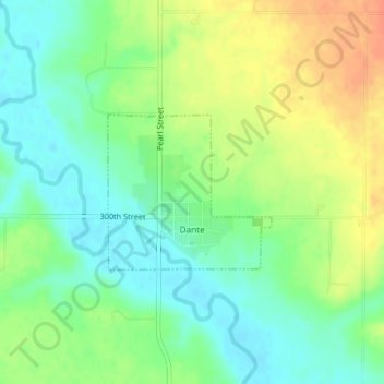
Name: Dante topographic map, elevation, terrain.
Location: Dante, Charles Mix County, South Dakota, United States (43.03578 -98.19239 43.04672 -98.17660)
Average elevation: 1,424 ft
Minimum elevation: 1,365 ft
Maximum elevation: 1,503 ft
South Dakota trails, hiking, mountain biking, running and outdoor activities
Thank you for supporting this site ❤️
Make a donation
Make a donation
Gear up for your next adventure:
As an Amazon Associate, this site earns from qualifying purchases at no extra cost to you.