
Thank you for supporting this site ❤️
Make a donation
Make a donation
Gear up for your next adventure:
As an Amazon Associate, this site earns from qualifying purchases at no extra cost to you.
Dromedary topographic map
Click on the map to display elevation.
Thank you for supporting this site ❤️
Make a donation
Make a donation
Gear up for your next adventure:
As an Amazon Associate, this site earns from qualifying purchases at no extra cost to you.
About this map
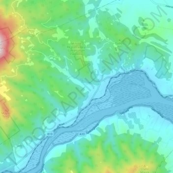
Name: Dromedary topographic map, elevation, terrain.
Location: Dromedary, Hobart, Brighton, Tasmania, 7030, Australia (-42.76982 147.10476 -42.69488 147.20011)
Average elevation: 587 ft
Minimum elevation: -16 ft
Maximum elevation: 2,986 ft
Thank you for supporting this site ❤️
Make a donation
Make a donation
Gear up for your next adventure:
As an Amazon Associate, this site earns from qualifying purchases at no extra cost to you.