Geolocate

Caguray topographic map

Click on the map to display elevation.

About this map

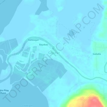
Name: Caguray topographic map, elevation, terrain.

Location: Caguray, Occidental Mindoro, Mimaropa, Philippines (12.26405 121.09521 12.30405 121.13521)

Average elevation: 16 ft

Minimum elevation: -16 ft

Maximum elevation: 249 ft

Gear up for your next adventure:

📦Gear Storage Bags - Organize and protect outdoor equipment
🥘Titanium Cookware - Durable, featherlight pots and pans for backpacking
⛑️Personal Locator Beacon - Safety beacon for emergencies
🥩Freeze-Dried Meals - Nutritious and lightweight food for remote expeditions
Backpacking Tents - Weight-optimized shelters for multi-day topographic surveys

As an Amazon Associate, this site earns from qualifying purchases at no extra cost to you.