
Thank you for supporting this site ❤️
Make a donation
Make a donation
Gear up for your next adventure:
As an Amazon Associate, this site earns from qualifying purchases at no extra cost to you.
Collombey topographic map
Click on the map to display elevation.
Thank you for supporting this site ❤️
Make a donation
Make a donation
Gear up for your next adventure:
As an Amazon Associate, this site earns from qualifying purchases at no extra cost to you.
About this map
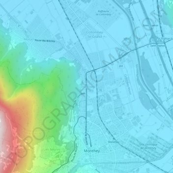
Name: Collombey topographic map, elevation, terrain.
Location: Collombey, Collombey-Muraz, Monthey, Valais, 1868, Suisse (46.24767 6.92607 46.28767 6.96607)
Average elevation: 1,640 ft
Minimum elevation: 1,260 ft
Maximum elevation: 4,065 ft
Thank you for supporting this site ❤️
Make a donation
Make a donation
Gear up for your next adventure:
As an Amazon Associate, this site earns from qualifying purchases at no extra cost to you.