
Kejimkujik National Park of Canada topographic map
Interactive map
Click on the map to display elevation.
About this map
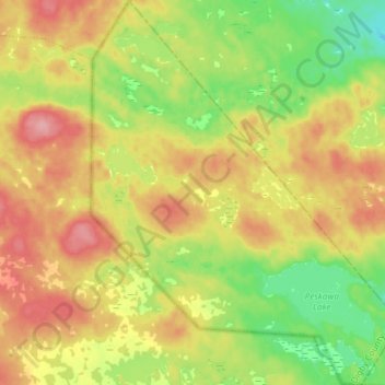
Name: Kejimkujik National Park of Canada topographic map, elevation, terrain.
Average elevation: 476 ft
Minimum elevation: 302 ft
Maximum elevation: 663 ft
Other topographic maps
Click on a map to view its topography, its elevation and its terrain.
Kejimkujik Lake
Canada > Nova Scotia > Kejimkujik National Park of Canada
Kejimkujik Lake, Jim Charles Loop, Kejimkujik National Park of Canada, Municipality of the County of Annapolis, Annapolis County, Nova Scotia, B0T 1N0, Canada
Average elevation: 292 ft