
Crișan topographic map
Interactive map
Click on the map to display elevation.
About this map
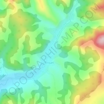
Name: Crișan topographic map, elevation, terrain.
Location: Crișan, Hunedoara, Romania (46.16559 22.78867 46.18120 22.80530)
Average elevation: 1,198 ft
Minimum elevation: 879 ft
Maximum elevation: 1,808 ft
Other topographic maps
Click on a map to view its topography, its elevation and its terrain.
Sălașu de Sus
Romania > Hunedoara > Sălașu de Sus
Sălașu de Sus, Hunedoara, 337420, Romania
Average elevation: 1,611 ft