Geolocate

Hughesville topographic map

Click on the map to display elevation.

About this map

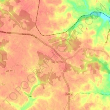
Name: Hughesville topographic map, elevation, terrain.

Location: Hughesville, Charles County, Maryland, 20637, United States (38.50783 -76.82111 38.56640 -76.73363)

Average elevation: 161 ft

Minimum elevation: 16 ft

Maximum elevation: 213 ft

Charles County trails, hiking, mountain biking, running and outdoor activities

Gear up for your next adventure:

🚑Emergency Bivvies - Heat-reflective sleeping bags for survival situations
❄️Traction Cleats - Prevent slips on icy trails during winter hikes
🛰️Handheld GPS Units - Professional satellite navigators for precise backcountry mapping
🦶Hiking Gaiters - Keep debris and water out of your boots
🛶Inflatable Kayak - Portable kayak for rivers, lakes, and expeditions

As an Amazon Associate, this site earns from qualifying purchases at no extra cost to you.