
Make a donation
Gear up for your next adventure:
As an Amazon Associate, this site earns from qualifying purchases at no extra cost to you.
Moore Lake topographic map
Click on the map to display elevation.
Make a donation
Gear up for your next adventure:
As an Amazon Associate, this site earns from qualifying purchases at no extra cost to you.
About this map
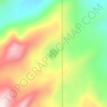
Name: Moore Lake topographic map, elevation, terrain.
Location: Moore Lake, Lake County, Montana, United States (47.61957 -113.88707 47.62183 -113.88327)
Average elevation: 5,925 ft
Minimum elevation: 4,954 ft
Maximum elevation: 7,044 ft
Lake County trails, hiking, mountain biking, running and outdoor activities
Make a donation
Gear up for your next adventure:
As an Amazon Associate, this site earns from qualifying purchases at no extra cost to you.
Other topographic maps
Click on a map to view its topography, its elevation and its terrain.
Make a donation
Gear up for your next adventure:
As an Amazon Associate, this site earns from qualifying purchases at no extra cost to you.
North Swan Valley Wildlife Management Area
United States > Montana > Lake County
Average elevation: 4,039 ft