
Mamquam River topographic map
Interactive map
Click on the map to display elevation.
About this map
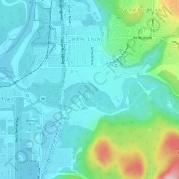
Name: Mamquam River topographic map, elevation, terrain.
Average elevation: 184 ft
Minimum elevation: 0 ft
Maximum elevation: 935 ft
Other topographic maps
Click on a map to view its topography, its elevation and its terrain.
Squamish River
Canada > British Columbia > Squamish
Squamish River, Squamish, Squamish-Lillooet Regional District, British Columbia, V8B 0A9, Canada
Average elevation: 823 ft
Stawamus Chief 2nd Peak
Canada > British Columbia > Squamish
Stawamus Chief 2nd Peak, Squamish, Squamish-Lillooet Regional District, British Columbia, V0N 3G0, Canada
Average elevation: 945 ft
Cheakamus River
Canada > British Columbia > Squamish
Cheakamus River, Squamish, Squamish-Lillooet Regional District, British Columbia, V0N 0A4, Canada
Average elevation: 161 ft
Murrin Provincial Park
Canada > British Columbia > Squamish
Murrin Provincial Park, Loop Trail, Squamish, Squamish-Lillooet Regional District, British Columbia, V0N 1J0, Canada
Average elevation: 541 ft
Brohm River
Canada > British Columbia > Squamish
Brohm River, Squamish, Squamish-Lillooet Regional District, British Columbia, V0N 0A4, Canada
Average elevation: 1,309 ft
Cheekye River
Canada > British Columbia > Squamish
Cheekye River, Squamish, Squamish-Lillooet Regional District, British Columbia, V0N 0A4, Canada
Average elevation: 781 ft