
Ryceville topographic map
Click on the map to display elevation.
About this map
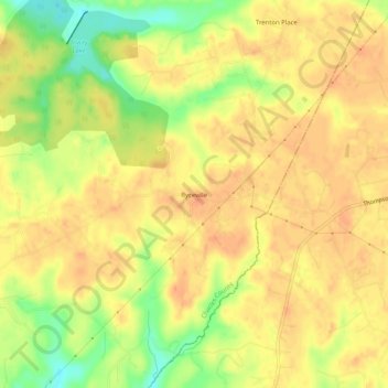
Name: Ryceville topographic map, elevation, terrain.
Location: Ryceville, Charles County, Maryland, 20622, United States (38.41568 -76.85052 38.45568 -76.81052)
Average elevation: 151 ft
Minimum elevation: 52 ft
Maximum elevation: 197 ft
Charles County trails, hiking, mountain biking, running and outdoor activities