
Thank you for supporting this site ❤️
Make a donation
Make a donation
Gear up for your next adventure:
As an Amazon Associate, this site earns from qualifying purchases at no extra cost to you.
Willebadessen topographic map
Click on the map to display elevation.
Thank you for supporting this site ❤️
Make a donation
Make a donation
Gear up for your next adventure:
As an Amazon Associate, this site earns from qualifying purchases at no extra cost to you.
About this map
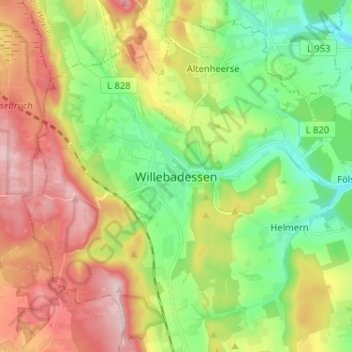
Name: Willebadessen topographic map, elevation, terrain.
Location: Willebadessen, Kreis Höxter, Nordrhein-Westfalen, Deutschland (51.58578 8.99426 51.66578 9.07426)
Average elevation: 945 ft
Minimum elevation: 591 ft
Maximum elevation: 1,430 ft
Thank you for supporting this site ❤️
Make a donation
Make a donation
Gear up for your next adventure:
As an Amazon Associate, this site earns from qualifying purchases at no extra cost to you.