Geolocate

Ashtabula topographic map

Click on the map to display elevation.

About this map

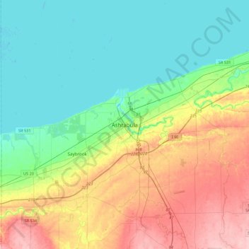
Name: Ashtabula topographic map, elevation, terrain.

Location: Ashtabula, Ashtabula County, Ohio, 44004, United States (41.70505 -80.94981 42.02505 -80.62981)

Average elevation: 719 ft

Minimum elevation: 558 ft

Maximum elevation: 1,050 ft

Ashtabula County trails, hiking, mountain biking, running and outdoor activities

Gear up for your next adventure:

Camping Coffee Makers - Enjoy premium coffee at the summit or campsite
🗻Climbing Gear Basics - Essential gear for beginner climbers
🚪Portable Camp Chair - Foldable chair for comfort at camp
🪶Camping Sleeping Pad - Comfortable sleeping pad for backpacking
🪶Trail Camera - Capture wildlife on your hikes

As an Amazon Associate, this site earns from qualifying purchases at no extra cost to you.