Geolocate

Olney topographic map

Click on the map to display elevation.

About this map

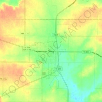
Name: Olney topographic map, elevation, terrain.

Location: Olney, Young County, Texas, 76374, United States (33.33112 -98.79669 33.41112 -98.71669)

Average elevation: 1,220 ft

Minimum elevation: 1,148 ft

Maximum elevation: 1,286 ft

Young County trails, hiking, mountain biking, running and outdoor activities

Gear up for your next adventure:

🔌Solar Panel Charger - Charge gear sustainably outdoors
🪶Camp Gear Gift Set - Perfect gift bundle for outdoor fans
Solar GPS Watches - Advanced multisport watches with built-in topographic maps
⛑️Personal Locator Beacon - Safety beacon for emergencies
🥾Hiking Shoes - Durable and comfortable shoes for trail hiking

As an Amazon Associate, this site earns from qualifying purchases at no extra cost to you.