
Thank you for supporting this site ❤️
Make a donation
Make a donation
Gear up for your next adventure:
As an Amazon Associate, this site earns from qualifying purchases at no extra cost to you.
Bensekrane topographic map
Click on the map to display elevation.
Thank you for supporting this site ❤️
Make a donation
Make a donation
Gear up for your next adventure:
As an Amazon Associate, this site earns from qualifying purchases at no extra cost to you.
About this map
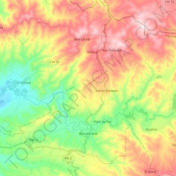
Name: Bensekrane topographic map, elevation, terrain.
Location: Bensekrane, Bensekrane District, Tilimsen, Algeria (35.04613 -1.34291 35.17563 -1.15877)
Average elevation: 1,316 ft
Minimum elevation: 499 ft
Maximum elevation: 2,260 ft
Thank you for supporting this site ❤️
Make a donation
Make a donation
Gear up for your next adventure:
As an Amazon Associate, this site earns from qualifying purchases at no extra cost to you.