Geolocate

Osseck topographic map

Click on the map to display elevation.

About this map

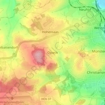
Name: Osseck topographic map, elevation, terrain.

Location: Osseck, Hof, Bayern, 95030, Deutschland (50.28573 11.85798 50.32573 11.89798)

Average elevation: 1,808 ft

Minimum elevation: 1,545 ft

Maximum elevation: 2,057 ft

Gear up for your next adventure:

Camping Coffee Makers - Enjoy premium coffee at the summit or campsite
🥾Men's Hiking Boots - Durable, waterproof footwear for rugged terrain and steep inclines
🚁Photography Drones - Capture stunning aerial views of landforms and topography
🧴Hand Sanitizer - Keep hands clean while hiking
🕶️Glacier Sunglasses - Side shields to protect eyes from high-altitude snow glare

As an Amazon Associate, this site earns from qualifying purchases at no extra cost to you.