
Make a donation
Gear up for your next adventure:
As an Amazon Associate, this site earns from qualifying purchases at no extra cost to you.
Ubstadt-Weiher topographic map
Click on the map to display elevation.
Make a donation
Gear up for your next adventure:
As an Amazon Associate, this site earns from qualifying purchases at no extra cost to you.
Ubstadt-Weiher
Der Gemeinderat hat normalerweise 18 ehrenamtliche Mitglieder, die für fünf Jahre gewählt werden. Die Zahl der Mitglieder kann sich durch Ausgleichssitze erhöhen (gesamt 2019: 18 Sitze; 2014: 20). Hinzu kommt der Bürgermeister als stimmberechtigter Gemeinderatsvorsitzender.
Make a donation
Gear up for your next adventure:
As an Amazon Associate, this site earns from qualifying purchases at no extra cost to you.
About this map
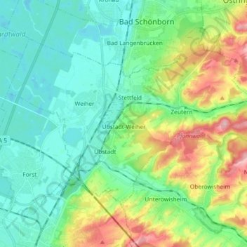
Name: Ubstadt-Weiher topographic map, elevation, terrain.
Average elevation: 463 ft
Minimum elevation: 331 ft
Maximum elevation: 794 ft
Make a donation
Gear up for your next adventure:
As an Amazon Associate, this site earns from qualifying purchases at no extra cost to you.