
Thank you for supporting this site ❤️
Make a donation
Make a donation
Gear up for your next adventure:
As an Amazon Associate, this site earns from qualifying purchases at no extra cost to you.
Loans topographic map
Click on the map to display elevation.
Thank you for supporting this site ❤️
Make a donation
Make a donation
Gear up for your next adventure:
As an Amazon Associate, this site earns from qualifying purchases at no extra cost to you.
About this map
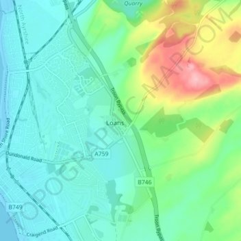
Name: Loans topographic map, elevation, terrain.
Location: Loans, South Ayrshire, Scotland, KA10 7LP, United Kingdom (55.53199 -4.64367 55.57199 -4.60367)
Average elevation: 125 ft
Minimum elevation: 0 ft
Maximum elevation: 489 ft
Thank you for supporting this site ❤️
Make a donation
Make a donation
Gear up for your next adventure:
As an Amazon Associate, this site earns from qualifying purchases at no extra cost to you.