Geolocate

Catania topographic map

Click on the map to display elevation.

About this map

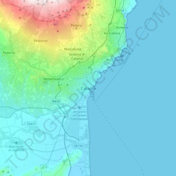
Name: Catania topographic map, elevation, terrain.

Location: Catania, Sicily, Italy (37.34236 14.92737 37.66236 15.24737)

Average elevation: 486 ft

Minimum elevation: -3 ft

Maximum elevation: 3,852 ft

Gear up for your next adventure:

🛌Ultralight Sleeping Bags - Compact down bags for cold nights in the wilderness
🦶Hiking Gaiters - Keep debris and water out of your boots
🪶Camping Sleeping Pad - Comfortable sleeping pad for backpacking
🧦Hiking Socks - Comfortable socks to prevent blisters on long hikes
🔭Compact Binoculars - HD vision for scouting terrain and identifying distant landmarks

As an Amazon Associate, this site earns from qualifying purchases at no extra cost to you.