
Thank you for supporting this site ❤️
Make a donation
Make a donation
Gear up for your next adventure:
As an Amazon Associate, this site earns from qualifying purchases at no extra cost to you.
白杨林 topographic map
Click on the map to display elevation.
Thank you for supporting this site ❤️
Make a donation
Make a donation
Gear up for your next adventure:
As an Amazon Associate, this site earns from qualifying purchases at no extra cost to you.
About this map
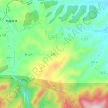
Name: 白杨林 topographic map, elevation, terrain.
Location: 白杨林, 宝鸡市, 陕西省, 中国 (35.03778 106.66162 35.07778 106.70162)
Average elevation: 5,289 ft
Minimum elevation: 4,741 ft
Maximum elevation: 6,270 ft
Thank you for supporting this site ❤️
Make a donation
Make a donation
Gear up for your next adventure:
As an Amazon Associate, this site earns from qualifying purchases at no extra cost to you.