
Thank you for supporting this site ❤️
Make a donation
Make a donation
Gear up for your next adventure:
As an Amazon Associate, this site earns from qualifying purchases at no extra cost to you.
Kais topographic map
Click on the map to display elevation.
Thank you for supporting this site ❤️
Make a donation
Make a donation
Gear up for your next adventure:
As an Amazon Associate, this site earns from qualifying purchases at no extra cost to you.
About this map
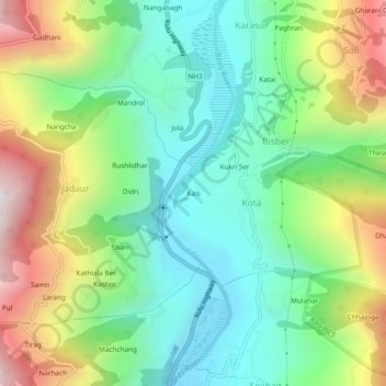
Name: Kais topographic map, elevation, terrain.
Location: Kais, Kota, Kullu, Himachal Pradesh, 175128, India (31.99890 77.10932 32.03890 77.14932)
Average elevation: 5,446 ft
Minimum elevation: 4,094 ft
Maximum elevation: 7,963 ft
Thank you for supporting this site ❤️
Make a donation
Make a donation
Gear up for your next adventure:
As an Amazon Associate, this site earns from qualifying purchases at no extra cost to you.