
Thank you for supporting this site ❤️
Make a donation
Make a donation
Gear up for your next adventure:
As an Amazon Associate, this site earns from qualifying purchases at no extra cost to you.
Muzaffarabad topographic map
Click on the map to display elevation.
Thank you for supporting this site ❤️
Make a donation
Make a donation
Gear up for your next adventure:
As an Amazon Associate, this site earns from qualifying purchases at no extra cost to you.
About this map
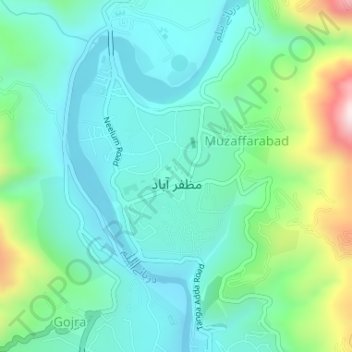
Name: Muzaffarabad topographic map, elevation, terrain.
Location: Muzaffarabad, Muzaffarabad Districts, Azad Kashmir, Pakistan (34.36595 73.46108 34.38205 73.47554)
Average elevation: 2,602 ft
Minimum elevation: 2,192 ft
Maximum elevation: 3,885 ft
Thank you for supporting this site ❤️
Make a donation
Make a donation
Gear up for your next adventure:
As an Amazon Associate, this site earns from qualifying purchases at no extra cost to you.