
Make a donation
Gear up for your next adventure:
As an Amazon Associate, this site earns from qualifying purchases at no extra cost to you.
Wyoming topographic map
Click on the map to display elevation.
Make a donation
Gear up for your next adventure:
As an Amazon Associate, this site earns from qualifying purchases at no extra cost to you.
Wyoming
The flood of 2011 prompted the evacuation of the Wilkes-Barre Wyoming Valley Airport (in southern Wyoming). The planes were moved to a higher elevation to prevent flood damage; they were relocated to the Wyoming Monument.
Make a donation
Gear up for your next adventure:
As an Amazon Associate, this site earns from qualifying purchases at no extra cost to you.
About this map
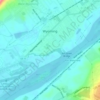
Name: Wyoming topographic map, elevation, terrain.
Location: Wyoming, Luzerne County, Pennsylvania, United States (41.29455 -75.86141 41.31773 -75.82214)
Average elevation: 571 ft
Minimum elevation: 522 ft
Maximum elevation: 886 ft
Make a donation
Gear up for your next adventure:
As an Amazon Associate, this site earns from qualifying purchases at no extra cost to you.