Geolocate

Verona topographic map

Click on the map to display elevation.

About this map

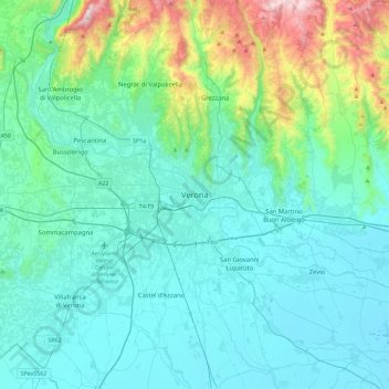
Name: Verona topographic map, elevation, terrain.

Location: Verona, Veneto, 37122, Italy (45.27850 10.83241 45.59850 11.15241)

Average elevation: 620 ft

Minimum elevation: 56 ft

Maximum elevation: 3,629 ft

Gear up for your next adventure:

🧢Sun Protection Hats - Wide-brimmed and UPF-rated hats for high-altitude sun safety
🎁Geography Themed Gifts - Unique gift ideas for map lovers and geography enthusiasts
🔥Camping Stove - Portable stove for camping and backcountry cooking
📱Solar Portable Charger - Solar power bank for charging devices off‑grid
🥇GPS Hiking Watch - Multi‑sport GPS watch with navigation and trail tracking

As an Amazon Associate, this site earns from qualifying purchases at no extra cost to you.