Geolocate

Modesto topographic map

Click on the map to display elevation.

About this map

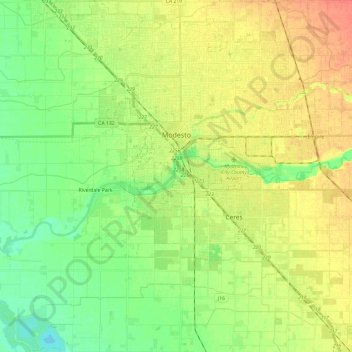
Name: Modesto topographic map, elevation, terrain.

Location: Modesto, Stanislaus County, California, United States (37.52193 -121.09647 37.71144 -120.90124)

Average elevation: 85 ft

Minimum elevation: 23 ft

Maximum elevation: 157 ft

Stanislaus County trails, hiking, mountain biking, running and outdoor activities

Other topographic maps

Click on a map to view its topography, its elevation and its terrain.

Oakdale

United States > California > Stanislaus County > Oakdale

Historically the area has been used for orchards and other agricultural uses. Some of the common soil types found in Oakdale are Delhi sand, Oakdale sandy loam, Hanford sandy loam, and Tujunga loamy sand. Oakdale is generally on level ground at an elevation of approximately 190 feet (58 m) above mean sea…

Average elevation: 217 ft

Gear up for your next adventure:

📱Solar Portable Charger - Solar power bank for charging devices off‑grid
🧯Portable Fire Pit - Compact fire pit for camping spots
🧭Outdoor Navigation Book - Learn advanced navigation skills
🔭Stargazing Telescopes - Perfect for camping in low-light pollution areas shown on maps
💧Water Purification System - Clean water on the trail with reliable purifiers

As an Amazon Associate, this site earns from qualifying purchases at no extra cost to you.