Geolocate

Pawnee topographic map

Click on the map to display elevation.

About this map

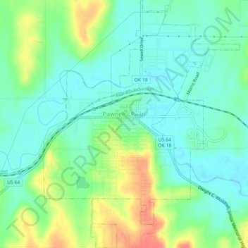
Name: Pawnee topographic map, elevation, terrain.

Location: Pawnee, Pawnee County, Oklahoma, 74058, United States (36.31883 -96.81789 36.35502 -96.78224)

Average elevation: 876 ft

Minimum elevation: 814 ft

Maximum elevation: 1,004 ft

Oklahoma trails, hiking, mountain biking, running and outdoor activities

Gear up for your next adventure:

🔥Camping Stove - Portable stove for camping and backcountry cooking
🪶Fire Starter Kit - Reliable fire starter for survival and camping
🧭GPS Watch Accessories - Bands and chargers for GPS watches
🔊Portable Camp Speaker - Music and alerts at camp
🪓Survival Multi‑Tool - Versatile tool for camp and trail tasks

As an Amazon Associate, this site earns from qualifying purchases at no extra cost to you.