Geolocate

睢宁县 topographic map

Click on the map to display elevation.

About this map

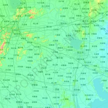
Name: 睢宁县 topographic map, elevation, terrain.

Location: 睢宁县, Jiangsu, China (33.23882 117.15877 34.63882 118.55877)

Average elevation: 92 ft

Minimum elevation: 26 ft

Maximum elevation: 1,070 ft

Gear up for your next adventure:

❄️Traction Cleats - Prevent slips on icy trails during winter hikes
🗺️Topographic Maps - Detailed topo maps for hiking, exploring and outdoor navigation
🛡️Bear Spray Outdoor - Protection in bear country hikes
🪶Survival Guide Book - Expert advice for emergency preparedness
🥾Women's Hiking Boots - Top-rated trail boots with ankle support and superior grip

As an Amazon Associate, this site earns from qualifying purchases at no extra cost to you.