
Thank you for supporting this site ❤️
Make a donation
Make a donation
Gear up for your next adventure:
As an Amazon Associate, this site earns from qualifying purchases at no extra cost to you.
Fleurier topographic map
Click on the map to display elevation.
Thank you for supporting this site ❤️
Make a donation
Make a donation
Gear up for your next adventure:
As an Amazon Associate, this site earns from qualifying purchases at no extra cost to you.
About this map
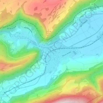
Name: Fleurier topographic map, elevation, terrain.
Location: Fleurier, Val-de-Travers, Neuchâtel, 2114, Suisse (46.88428 6.56004 46.92428 6.60004)
Average elevation: 2,930 ft
Minimum elevation: 2,392 ft
Maximum elevation: 4,131 ft
Thank you for supporting this site ❤️
Make a donation
Make a donation
Gear up for your next adventure:
As an Amazon Associate, this site earns from qualifying purchases at no extra cost to you.