Geolocate

Adin topographic map

Click on the map to display elevation.

About this map

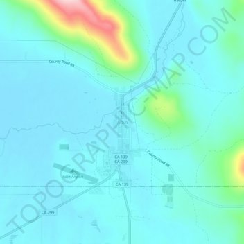
Name: Adin topographic map, elevation, terrain.

Location: Adin, Modoc County, California, 96006, United States (41.17484 -120.96423 41.21484 -120.92423)

Average elevation: 4,291 ft

Minimum elevation: 4,180 ft

Maximum elevation: 4,948 ft

Modoc County trails, hiking, mountain biking, running and outdoor activities

Other topographic maps

Click on a map to view its topography, its elevation and its terrain.

Homestead Flat

United States > California > Modoc County

Average elevation: 7,425 ft

Gear up for your next adventure:

🦶Carbon Trekking Poles - Reduce knee impact on steep descents with ultra-light poles
🏕️Family Camping Gear - Essentials for group camping trips
🗺️Topographic Maps - Detailed topo maps for hiking, exploring and outdoor navigation
🧤Tactile Hiking Gloves - Keep hands warm while operating GPS and smartphone screens
🎒Day Hiking Backpack - Lightweight backpack perfect for day trips and outdoor adventures

As an Amazon Associate, this site earns from qualifying purchases at no extra cost to you.