Geolocate

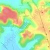
Verem topographic map

Click on the map to display elevation.

About this map

Name: Verem topographic map, elevation, terrain.

Location: Verem, Bardez, North Goa, Goa, 403511, India (15.48878 73.78840 15.52878 73.82840)

Average elevation: 59 ft

Minimum elevation: -7 ft

Maximum elevation: 230 ft

Other topographic maps

Click on a map to view its topography, its elevation and its terrain.

Anjuna

India > Goa > Bardez > Vagator

Average elevation: 39 ft

Pilerne Lake

India > Goa > Bardez > Sangolda

Average elevation: 128 ft

Corjuem Fort

India > Goa > Bardez > Corjuem

Average elevation: 43 ft

Aguada Fort

India > Goa > Bardez > Sinquerim

Average elevation: 26 ft

Anjuna

India > Goa > Bardez

Average elevation: 43 ft

Anjuna Beach

India > Goa > Bardez > Anjuna

Average elevation: 33 ft

Mapusa

India > Goa > Bardez

Mapusa is located at 15°36′N 73°49′E / 15.60°N 73.82°E / 15.60; 73.82. It has an average elevation of 15 metres (49 feet). It lies on the banks of Mapusa River. Mapusa has a tropical climate with temperatures ranging from a high of 37 °C in summer with high levels of humidity to a low of 21 °C in winters.

Average elevation: 95 ft

Chapora Fort

India > Goa > Bardez > Chapora

Average elevation: 26 ft

Gear up for your next adventure:

🪶Compact Camp Shovel - Folding shovel for campsite tasks
🔥Plasma Lighters - Windproof lighters that work in any weather condition
📷Action Camera - Capture your outdoor adventures in HD
🔋Solar Power Banks - Keep your GPS and phone charged in remote wilderness areas
🪶LED Camping Lantern - Bright lantern for camp lighting

As an Amazon Associate, this site earns from qualifying purchases at no extra cost to you.